Equidistant Conic Projection Map of the Eclipse Path
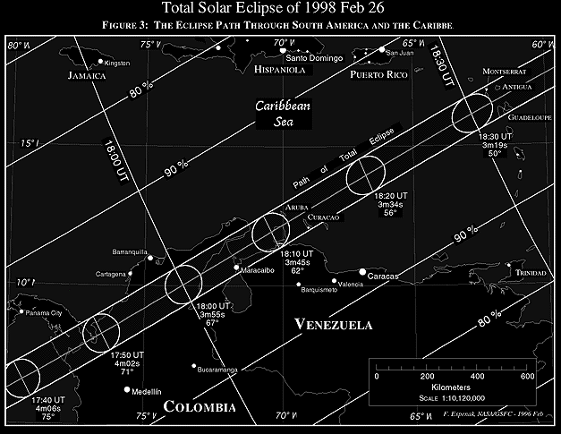
Figure 3
is an equidistant conic projection map chosen to minimize
distortion, and which isolates a specific region of the umbral
path. Once again, curves of maximum eclipse and constant eclipse
magnitude are plotted and labeled. A linear scale is included
for estimating approximate distances (kilometers). Within the
northern and southern limits of the path of totality, the outline
of the umbral shadow is plotted at ten minute intervals. The duration
of totality (minutes and seconds) and the Sun's altitude correspond
to the local circumstances on the center line at each shadow position.
The scale used in
Figure 3
is approximately ~1:10,000,000. The
positions of larger cities and metropolitan areas in and near
the umbral path are depicted as black dots. The size of each city
is logarithmically proportional to its population using 1990 census
data (Rand McNally, 1991).
1990 census data (Rand McNally, 1991).
 Next section
 Table of Contents