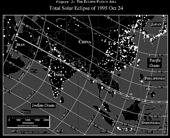
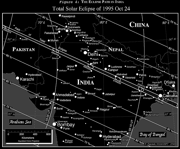
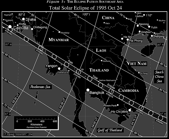
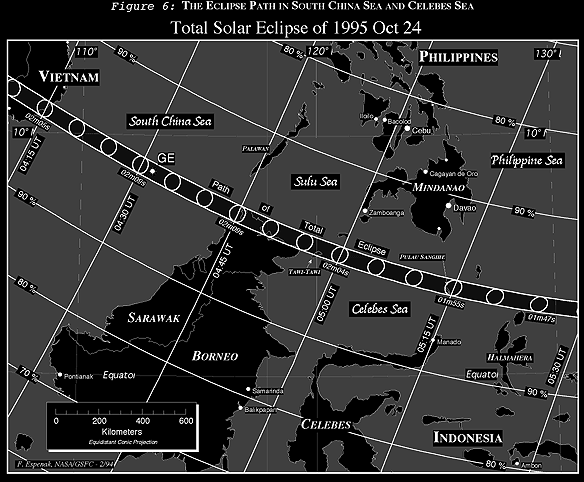
Equidistant Conic Projection Maps of the Eclipse Path
Figures 3,
4,
5, and
6
are equidistant conic projection maps that isolate
specific regions of the eclipse path. The projection was selected to minimize
distortion over the regions depicted. Once again, curves of maximum eclipse
and constant eclipse magnitude are plotted and labeled. A linear scale is
included for estimating approximate distances (kilometers) in each figure.
Within the northern and southern limits of the path of totality, the outline of
the umbral shadow is plotted at five minute intervals. The center line
duration of totality appears near the umbra at various points along the path.
Figure 3 is drawn at a scale of
~1:11,060,000, while Figures
4,
5, and
6 are
drawn at a scale of ~1:3,250,000. All four figures include the positions of
many of the larger cities or metropolitan areas in and near the central path.
The size of each city is logarithmically proportional to its population
according to 1990 census data (Rand McNally, 1991).
 Next section
 Table of Contents