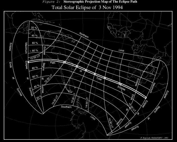
The stereographic projection of Earth in Figure 2 depicts the path of penumbral and umbral eclipse in greater detail. The map is oriented with the point of greatest eclipse near the center and north is at the top. International political borders are shown and circles of latitude and longitude at plotted at 20 deg increments. The saddle shaped region of penumbral or partial eclipse includes labels identifying the northern and southern limits, curves of eclipse begins or ends at sunrise, curves of eclipse begins or ends at sunset, and curves of maximum eclipse at sunrise and sunset. Curves of constant eclipse magnitude are plotted for 20%, 40%, 60% and 80%, as are the limits of the path of total eclipse. Also included are curves of greatest eclipse for every thirty minutes Universal Time.
Figures 1 and 2 may be used to quickly determine the approximate time and magnitude of greatest eclipse for any location from which the eclipse is visible.